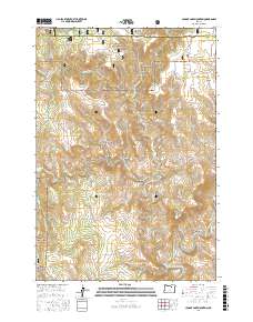
2017 Map of Johnny Cake Mountain
USGS Topo · Published 2017About this map
Umatilla National Forest encompasses much of this high-elevation landscape where Morrow and Grant counties meet. The topography is defined by complex drainage systems and volcanic-named landmarks, most notably the high point at Johnny Cake Mountain and the distinct volcanic form of Neal Butte. The map details an intricate network of forest development roads, including Natl Forest Develop Road 140 RD and Natl Forest Develop Road 026 RD, which navigate around deep incisions such as Mulligan Stew Canyon and Boneyard Canyon. Perennial water sources like Buckhorn Spring and Tonto Spring appear alongside the headwaters of numerous creeks, including Little Wall Cr and Big Wall Cr. In the southeastern corner, the terrain drops toward the North Fork John Day River, illustrating the rugged transitions between the high plateaus of Mahogany Flat and the deep river canyons that characterize this part of the Blue Mountains.
Find a feature on this map
43 named features on this map. Tap any name to fly to it.
Don’t see what you’re looking for? This feature index may not catch every label — zoom into the map to look around manually.
Map Details
Editions of this 2017 Johnny Cake Mountain Map
This is the sole edition of this map. No revisions or reprints were ever made.
Other maps of this area

1951 · Monument
USGS Topo · 1:62,500

1953 · Kimberly
USGS Topo · 1:62,500

1953 · Pendleton
USGS Topo · 1:250,000

1955 · Canyon City
USGS Topo · 1:250,000

1956 · Pendleton
USGS Topo · 1:250,000

1959 · Canyon City
USGS Topo · 1:250,000

1969 · Lake Penland
USGS Topo · 1:24,000

1969 · Madison Butte
USGS Topo · 1:24,000

1969 · Big Rock Flat
USGS Topo · 1:24,000

1980 · Monument
USGS Topo · 1:100,000