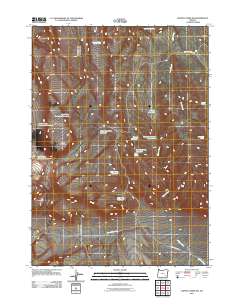
2011 Map of Johnny Creek SW
USGS Topo · Published 2011About this map
Table Mountain dominates this portion of Malheur County, serving as a focal point for a complex network of upland water management. The landscape is defined by its collection of isolated water sources, essential for rangeland utility in this arid environment. Strategic catchments such as Steel Post Reservoir, Three Forks Reservoir, and Bobcat Reservoir are distributed across the terrain, reflecting the necessity of water storage for livestock and wildlife. These features, along with named springs like Antelope Spring Number Three and Sagehen Spring, dictate the placement of local thoroughfares including 3 Forks Reservoir Rd and Wildcat Creek Rd. The drainage systems of Heath Creek and Wildcat Creek provide the primary hydrologic structure for this high-desert region, connecting the various reservoirs and springs.
Find a feature on this map
20 named features on this map. Tap any name to fly to it.
Don’t see what you’re looking for? This feature index may not catch every label — zoom into the map to look around manually.
Map Details
Editions of this 2011 Johnny Creek SW Map
This is the sole edition of this map. No revisions or reprints were ever made.
Other maps of this area

1955 · Adel
USGS Topo · 1:250,000

1957 · Adel
USGS Topo · 1:250,000

1958 · Adel
USGS Topo · 1:250,000

1962 · Adel
USGS Topo · 1:250,000
1980 · Johnny Creek Spring
USGS Topo · 1:24,000
1981 · Grassy Ridge Well
USGS Topo · 1:24,000
1981 · Johnny Creek SW
USGS Topo · 1:24,000
1981 · Groan Canyon
USGS Topo · 1:24,000

1981 · Ancient Lake Well
USGS Topo · 1:24,000
1981 · Juniper Lake
USGS Topo · 1:24,000