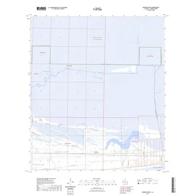
2024 Map of Johnson Bayou
USGS Topo · Published 2024About this map
The Sabine National Wildlife Refuge anchors the northern reaches of this coastal landscape, where the marshy terrain is defined by a complex network of waterways and industrial features. Deep Bayou and Starks South Canal cut through the wetlands, reflecting a history of both natural drainage and human modification. The presence of the Magnolia Vacuum Canal and the Cameron Meadows Oil Field Rd indicates the area's long-standing connection to coastal industry.
Find a feature on this map
32 named features on this map. Tap any name to fly to it.
Don’t see what you’re looking for? This feature index may not catch every label — zoom into the map to look around manually.
Map Details
Editions of this 2024 Johnson Bayou Map
This is the sole edition of this map. No revisions or reprints were ever made.
Other maps of this area

1932 · Sabine Pass NE
USGS Topo · 1:31,680

1932 · Port Arthur NE
USGS Topo · 1:31,680

1934 · Johnsons Bayou
USGS Topo · 1:24,000

1934 · Peveto Beach
USGS Topo · 1:24,000

1934 · Greens Bayou
USGS Topo · 1:24,000

1934 · Five Lakes
USGS Topo · 1:24,000

1935 · Peveto Beach
USGS Topo · 1:31,680

1935 · Five Lakes
USGS Topo · 1:31,680

1935 · Greens Bayou
USGS Topo · 1:31,680

1935 · Johnsons Bayou
USGS Topo · 1:31,680