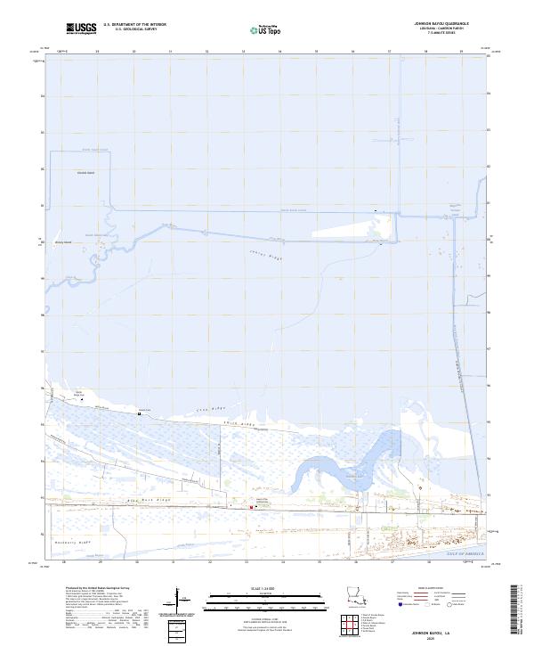
2025 Map of Johnson Bayou
USGS Topo · Published 2025About this map
Junius Ridge and a series of elevated landforms including Smith Ridge and Blue Buck Ridge define this coastal landscape in Cameron Parish. The map reveals the intricate water management and industrial infrastructure of the region, featuring the Magnolia Vacuum Canal, Starks South Canal, and the Cameron Meadows Oil Field Rd. For genealogists and local historians, several burial sites are documented across the ridges, specifically Smith Ridge Cem, Peveto Cem, and the Head of the Hollow Cem. The coastal edge is dominated by Hamilton Lake and Smith Bayou before meeting the Gulf of America. This survey illustrates the delicate balance of wetland ecology and human industry, where roads like Middle Ridge Rd follow the natural topography of the higher ground amidst expansive marshes and tidal waterways.
Find a feature on this map
26 named features on this map. Tap any name to fly to it.
Don’t see what you’re looking for? This feature index may not catch every label — zoom into the map to look around manually.
Map Details
Editions of this 2025 Johnson Bayou Map
This is the sole edition of this map. No revisions or reprints were ever made.
Other maps of this area

1932 · Sabine Pass NE
USGS Topo · 1:31,680

1932 · Port Arthur NE
USGS Topo · 1:31,680

1934 · Johnsons Bayou
USGS Topo · 1:24,000

1934 · Peveto Beach
USGS Topo · 1:24,000

1934 · Greens Bayou
USGS Topo · 1:24,000

1934 · Five Lakes
USGS Topo · 1:24,000

1935 · Peveto Beach
USGS Topo · 1:31,680

1935 · Five Lakes
USGS Topo · 1:31,680

1935 · Greens Bayou
USGS Topo · 1:31,680

1935 · Johnsons Bayou
USGS Topo · 1:31,680