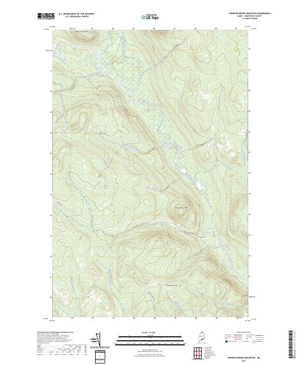
2024 Map of Johnson Brook Mountain
USGS Topo · Published 2024About this map
The Little Black River meanders through this remote portion of Aroostook County, Maine, carving a path through a landscape defined by significant drainage networks and isolated peaks. Named summits such as Boat Landing Mtn and Hafey Mtn overlook a dense system of tributaries, including Little Hafey Brook and Knowland Brook. The presence of features like Carrie Bogan and the surrounding marshy lowlands suggest a complex riparian environment where land use is largely dictated by the water's path. Access to this northern wilderness is provided by a network of logging and service roads, including Hafey Rd, Dickey Rd, and Irving Rd, which connect the various brooks and mountain bases. The concentration of family-named landmarks like Harvey Brook and Walker Brook provides a clear view into the local geographic nomenclature used in modern Maine forestry and conservation management.
Find a feature on this map
27 named features on this map. Tap any name to fly to it.
Don’t see what you’re looking for? This feature index may not catch every label — zoom into the map to look around manually.
Map Details
Editions of this 2024 Johnson Brook Mountain Map
This is the sole edition of this map. No revisions or reprints were ever made.
Other maps of this area

1930 · Allagash
USGS Topo · 1:48,000

1933 · Allagash
USGS Topo · 1:62,500

1955 · Rocky Mountain
USGS Topo · 1:62,500

1955 · Rocky Brook
USGS Topo · 1:62,500

1955 · Beau Lake
USGS Topo · 1:62,500

1962 · Edmundston
USGS Topo · 1:250,000
1986 · Big Rapids
USGS Topo · 1:24,000
1986 · Allagash
USGS Topo · 1:24,000

1987 · Beau Lake
USGS Topo · 1:24,000
1987 · Johnson Brook Mountain
USGS Topo · 1:24,000