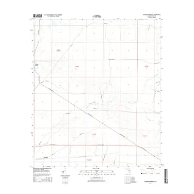
2015 Map of Johnson Hammock
USGS Topo · Published 2015About this map
Cabbage Grove and the namesake Johnson Hammock anchor this rural Taylor County landscape, where the Econfina River meanders toward the Gulf through a network of creeks and forest lands. The settlement of Econfina and the locality of Waylonzo are connected by a geometric grid of timber and access roads, including W Hampton Springs Avenue and Caggage Grove Road. The area's land use is largely defined by industrial forestry and infrastructure, evidenced by the long stretches of the Florida Power Corporation Road and numerous named grades like the Billy Martin Grade Road. Smaller waterways like Page Creek and Regular Creek drain the low-lying terrain, while locally significant thoroughfares such as Ralph Whiddon Road and Church Road provide access to interior tracts.
Find a feature on this map
31 named features on this map. Tap any name to fly to it.
Don’t see what you’re looking for? This feature index may not catch every label — zoom into the map to look around manually.
Map Details
Editions of this 2015 Johnson Hammock Map
This is the sole edition of this map. No revisions or reprints were ever made.
Other maps of this area

1952 · Secotan
USGS Topo · 1:24,000

1954 · Johnson Hammock
USGS Topo · 1:24,000

1954 · Hampton Springs
USGS Topo · 1:24,000

1954 · Secotan
USGS Topo · 1:24,000

1954 · Valdosta
USGS Topo · 1:250,000

1955 · Snipe Island
USGS Topo · 1:24,000

1955 · Shady Grove
USGS Topo · 1:24,000

1955 · Nutall Rise
USGS Topo · 1:24,000

1955 · Lamont SE
USGS Topo · 1:24,000

1955 · Manlin Hammock
USGS Topo · 1:24,000