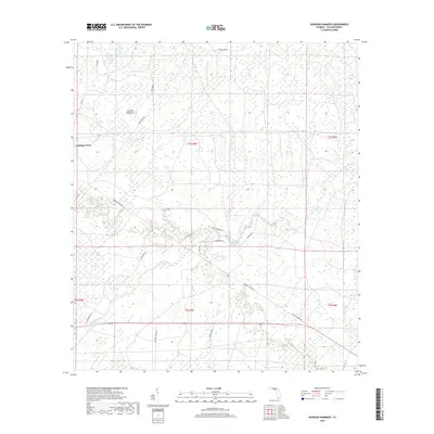
2018 Map of Johnson Hammock
USGS Topo · Published 2018About this map
Cabbage Grove and the namesake Johnson Hammock anchor this study of the low-lying interior of Taylor County. The landscape is defined by the winding course of the Econfina River, which draws in numerous local tributaries including Rose Creek, Natural Well Branch, and Page Creek. The settlement pattern is sparse, dominated by a grid of rural routes and specialized timber-related infrastructure like the Toby Tram and Cow Creek Grade. Local connectivity is maintained through named paths such as Cabbage Grove Rd and Whiddon Rd, while Cemetery Rd indicates a site of long-standing community importance near the riverbanks. This map reveals the continued reliance on these specific woodland grades and creek crossings that have shaped the region's geography for generations.
Find a feature on this map
28 named features on this map. Tap any name to fly to it.
Don’t see what you’re looking for? This feature index may not catch every label — zoom into the map to look around manually.
Map Details
Editions of this 2018 Johnson Hammock Map
This is the sole edition of this map. No revisions or reprints were ever made.
Other maps of this area

1952 · Secotan
USGS Topo · 1:24,000

1954 · Johnson Hammock
USGS Topo · 1:24,000

1954 · Hampton Springs
USGS Topo · 1:24,000

1954 · Secotan
USGS Topo · 1:24,000

1954 · Valdosta
USGS Topo · 1:250,000

1955 · Snipe Island
USGS Topo · 1:24,000

1955 · Shady Grove
USGS Topo · 1:24,000

1955 · Nutall Rise
USGS Topo · 1:24,000

1955 · Lamont SE
USGS Topo · 1:24,000

1955 · Manlin Hammock
USGS Topo · 1:24,000