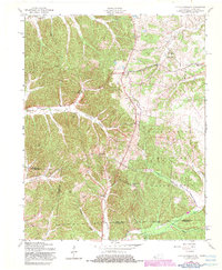
1957 Map of Johnson Hollow
USGS Topo · Published 1983About this map
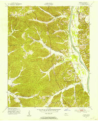
Fort Campbell Military Reservation occupies a significant portion of this terrain along the border of Kentucky and Tennessee. The landscape is defined by deep drainages like Johnson Hollow and Dry Creek, which dictate the placement of early settlements and rural infrastructure. While much of the eastern half is reserved for military use, the western hills contain a network of established community markers. Social life in the mid-20th century centered on gathering places such as Old Dry Creek Ch, Union Hill Ch, and the Pugh Flat Ch. Local education and family history are preserved in the vicinity of the Delmont Sch and its adjacent Delmont Cem. The map traces the transition from quiet farming hamlets like Donaldson and Rock Front to the expanding federal presence near the Trigg Co Stewart Co line.
Find a feature on this map
31 named features on this map. Tap any name to fly to it.
Don’t see what you’re looking for? This feature index may not catch every label — zoom into the map to look around manually.
Map Details
Editions of this 1957 Johnson Hollow Map
4 editions found
Other maps of this area

1936 · Tharpe
USGS Topo · 1:24,000

1950 · Caledonia
USGS Topo · 1:24,000

1951 · Caledonia
USGS Topo · 1:24,000

1951 · Model
USGS Topo · 1:24,000

1951 · Roaring Spring
USGS Topo · 1:24,000

1951 · Johnson Hollow
USGS Topo · 1:24,000
1951 · Tharpe
USGS Topo · 1:24,000

1951 · Indian Mound
USGS Topo · 1:24,000

1951 · Bumpus Mills
USGS Topo · 1:24,000

1953 · Canton
USGS Topo · 1:24,000