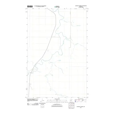
2010 Map of Johnson Landing
USGS Topo · Published 2010About this map
The Big Fork River carves a winding path through this northern Minnesota landscape, creating a series of dramatic oxbows and meanders that dominate the central geography. This 2010 survey by the U. S. Geological Survey captures the intricate hydrology of the region, where numerous tributaries such as Reilly Creek, Reilly Brook, and Macaffee Brook feed into the primary river system. The drainage pattern suggests a relatively flat, water-rich environment characteristic of this portion of Koochiching County. Human infrastructure is sparse, defined primarily by rural corridors such as Dentaybow Rd and Ut 83, which provide access to this wooded and wetland-heavy terrain. This map serves as an essential record of the natural waterways and the limited road network that connects the remote settlements in the Big Fork River valley.
Find a feature on this map
6 named features on this map. Tap any name to fly to it.
Don’t see what you’re looking for? This feature index may not catch every label — zoom into the map to look around manually.
Map Details
Editions of this 2010 Johnson Landing Map
This is the sole edition of this map. No revisions or reprints were ever made.
Other maps of this area

1918 · Zora
USGS Topo · 1:62,500

1919 · Zora
USGS Topo · 1:62,500

1919 · M
USGS Topo · 1:62,500

1919 · Margie
USGS Topo · 1:62,500

1954 · Hibbing
USGS Topo · 1:250,000

1954 · International Falls
USGS Topo · 1:250,000

1957 · Hibbing
USGS Topo · 1:250,000

1957 · International Falls
USGS Topo · 1:250,000

1958 · International Falls
USGS Topo · 1:250,000

1958 · Hibbing
USGS Topo · 1:250,000