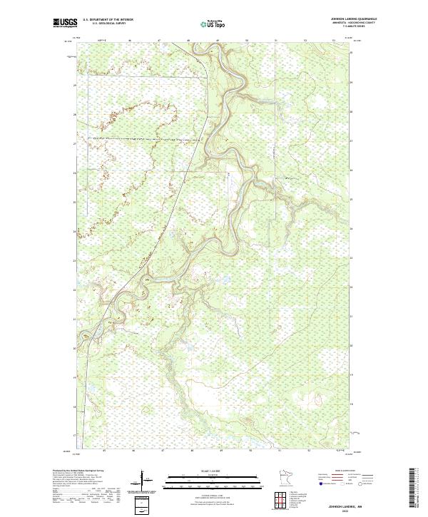
2022 Map of Johnson Landing
USGS Topo · Published 2022About this map
The Big Fork River meanders extensively through this heavily wetland-dominated landscape in Koochiching County, showing the characteristic oxbows and tight bends of a low-gradient waterway. This 2022 survey documents a remote section of northern Minnesota where the hydrology is defined by a dense network of marshes and small tributaries, including Reilly Brook, Macafee Brook, and Reilly Cr. Human infrastructure is sparse, limited primarily to Dentaybow Rd and Ut 83 which provide access through the dense wetlands. The map clearly delineates township boundaries such as t65n r26w and t64n r27w, which are essential for property research and understanding the Public Land Survey System in this wilderness area. The lack of named settlements reflects the primary use of the land for timber and conservation rather than permanent habitation.
Find a feature on this map
10 named features on this map. Tap any name to fly to it.
Don’t see what you’re looking for? This feature index may not catch every label — zoom into the map to look around manually.
Map Details
Editions of this 2022 Johnson Landing Map
This is the sole edition of this map. No revisions or reprints were ever made.
Other maps of this area

1918 · Zora
USGS Topo · 1:62,500

1919 · Zora
USGS Topo · 1:62,500

1919 · M
USGS Topo · 1:62,500

1919 · Margie
USGS Topo · 1:62,500

1954 · Hibbing
USGS Topo · 1:250,000

1954 · International Falls
USGS Topo · 1:250,000

1957 · Hibbing
USGS Topo · 1:250,000

1957 · International Falls
USGS Topo · 1:250,000

1958 · International Falls
USGS Topo · 1:250,000

1958 · Hibbing
USGS Topo · 1:250,000