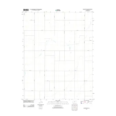
2012 Map of Johnson NW
USGS Topo · Published 2012About this map
Little Bear Cr meanders across this rural expanse of Stanton County, defining the primary drainage pattern for an otherwise strictly organized agricultural landscape. The area is dominated by the Jeffersonian grid system, where section lines are marked by a network of local thoroughfares such as Co Rd-37 and W Road 2. This 2012 survey illustrates the modern scale of High Plains farming, where isolated structures are linked by long, straight stretches like N Manter and N Road X. The absence of large town centers emphasizes the region's reliance on the transportation grid for rural connectivity between remote farmsteads and agricultural hubs. Notable east-west arteries including W Road 4 and W Road 8 provide the essential framework for a community defined by vast distances and water management.
Find a feature on this map
21 named features on this map. Tap any name to fly to it.
Don’t see what you’re looking for? This feature index may not catch every label — zoom into the map to look around manually.
Map Details
Editions of this 2012 Johnson NW Map
This is the sole edition of this map. No revisions or reprints were ever made.
Other maps of this area

1891 · Albany
USGS Topo · 1:125,000

1893 · Albany
USGS Topo · 1:125,000

1900 · Syracuse
USGS Topo · 1:125,000

1920 · Syracuse
USGS Topo · 1:125,000

1955 · La Junta
USGS Topo · 1:250,000

1955 · Dodge City
USGS Topo · 1:250,000

1958 · La Junta
USGS Topo · 1:250,000

1958 · Dodge City
USGS Topo · 1:250,000

1959 · Dodge City
USGS Topo · 1:250,000

1966 · Syracuse West SW
USGS Topo · 1:24,000