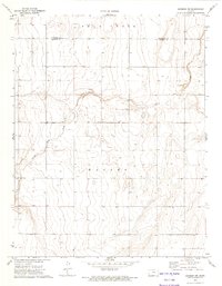
1973 Map of Johnson NW
USGS Topo · Published 1975About this map
The high plains of western Kansas are defined here by the winding drainage systems of Bear Creek and its tributary, Little Bear Creek. Located along the border between Hamilton Co and Stanton Co, the landscape is primarily characterized by the wide, flat expanse of Manter and the systematic grid of rural section lines. This 1973 field-checked survey reveals an era of intensive land management, evidenced by the numerous irrigation and resource extraction sites labeled simply as Well across the terrain.
Find a feature on this map
6 named features on this map. Tap any name to fly to it.
Don’t see what you’re looking for? This feature index may not catch every label — zoom into the map to look around manually.
Map Details
Editions of this 1973 Johnson NW Map
This is the sole edition of this map. No revisions or reprints were ever made.
Other maps of this area

1891 · Albany
USGS Topo · 1:125,000

1893 · Albany
USGS Topo · 1:125,000

1900 · Syracuse
USGS Topo · 1:125,000

1920 · Syracuse
USGS Topo · 1:125,000

1955 · La Junta
USGS Topo · 1:250,000

1955 · Dodge City
USGS Topo · 1:250,000

1958 · La Junta
USGS Topo · 1:250,000

1958 · Dodge City
USGS Topo · 1:250,000

1959 · Dodge City
USGS Topo · 1:250,000

1966 · Syracuse West SW
USGS Topo · 1:24,000