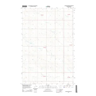
2014 Map of Johnson Reservoir
USGS Topo · Published 2014About this map
Johnson Reservoir and the complex drainage of the Deer Creek system define this landscape in Dawson County. The map details the convergence of N Fork Deer Cr, Middle Fork Deer Cr, and S Fork Deer Cr, illustrating how these intermittent waterways have carved the high plains of eastern Montana. This area is characterized by the Public Land Survey System grids of Township 18 and 19 North, where the terrain is marked by traditional section lines and a network of rural routes. Secondary roads such as Road 448 and Road 435 provide the primary access through this rangeland, connecting remote grazing lands to the larger regional infrastructure. The placement of the reservoir along the middle fork suggests the critical importance of water management in this arid agricultural environment during the early 21st century.
Find a feature on this map
16 named features on this map. Tap any name to fly to it.
Don’t see what you’re looking for? This feature index may not catch every label — zoom into the map to look around manually.
Map Details
Editions of this 2014 Johnson Reservoir Map
This is the sole edition of this map. No revisions or reprints were ever made.
Other maps of this area

1909 · Glendive
USGS Topo · 1:250,000

1954 · Glendive
USGS Topo · 1:250,000

1957 · Glendive
USGS Topo · 1:250,000

1958 · Glendive
USGS Topo · 1:250,000

1972 · Poverty Flat West
USGS Topo · 1:24,000

1972 · Bloomfield
USGS Topo · 1:24,000

1972 · Stinking Coulee
USGS Topo · 1:24,000

1981 · Glendive
USGS Topo · 1:100,000

1982 · Circle
USGS Topo · 1:100,000

1983 · Johnson Reservoir NW
USGS Topo · 1:24,000