
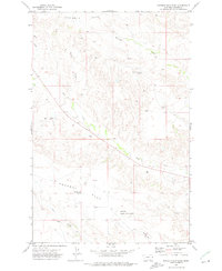
1972 Map of Stinking Coulee
USGS Topo · Published 1976About this map
Water management and topography define this Dawson County landscape during the early 1970s. The region is characterized by a complex drainage system where Stinking Coulee and Kelley Coulee intersect with larger waterways like Lower Sevenmile Creek and the North Fork Deer Creek. These drainage patterns reflect the essential role of water in this semi-arid environment, evidenced by livestock-related infrastructure such as Dickerson Dam and Kubesh Dam. Notable elevation markers like Twin Buttes and the flat-topped Table rise above the surrounding creek beds, while the presence of scattered drill holes suggests a landscape surveyed for its mineral potential. The map provides a look at the rural configuration of the High Plains before modern industrial shifts, showing the winding routes of Horse Creek and its East Fork through the dissected terrain.
Find a feature on this map
15 named features on this map. Tap any name to fly to it.
Don’t see what you’re looking for? This feature index may not catch every label — zoom into the map to look around manually.
Map Details
Editions of this 1972 Stinking Coulee Map
This is the sole edition of this map. No revisions or reprints were ever made.
Other maps of this area

1909 · Glendive
USGS Topo · 1:250,000

1954 · Glendive
USGS Topo · 1:250,000

1957 · Glendive
USGS Topo · 1:250,000

1958 · Glendive
USGS Topo · 1:250,000

1972 · Red Top
USGS Topo · 1:24,000

1972 · Morgan Creek School
USGS Topo · 1:24,000

1972 · Poverty Flat West
USGS Topo · 1:24,000

1972 · Bloomfield
USGS Topo · 1:24,000
1972 · Poverty Flat East
USGS Topo · 1:24,000

1981 · Glendive
USGS Topo · 1:100,000