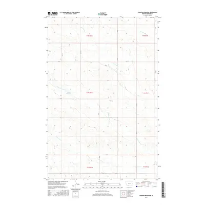
2017 Map of Johnson Reservoir
USGS Topo · Published 2017About this map
Johnson Reservoir sits at the heart of this Dawson County landscape, serving as a primary water source in an area defined by the branching drainage of Deer Creek. The terrain is deeply etched by the N Fork Deer Cr, Middle Fork Deer Cr, and S Fork Deer Cr, which together form a complex hydraulic network across the rangeland. In the northeast corner, Lower Sevenmile Cr cuts across the township boundary of T19N R53E, further illustrating the importance of natural drainage in this part of Montana.
Find a feature on this map
19 named features on this map. Tap any name to fly to it.
Don’t see what you’re looking for? This feature index may not catch every label — zoom into the map to look around manually.
Map Details
Editions of this 2017 Johnson Reservoir Map
This is the sole edition of this map. No revisions or reprints were ever made.
Other maps of this area

1909 · Glendive
USGS Topo · 1:250,000

1954 · Glendive
USGS Topo · 1:250,000

1957 · Glendive
USGS Topo · 1:250,000

1958 · Glendive
USGS Topo · 1:250,000

1972 · Poverty Flat West
USGS Topo · 1:24,000

1972 · Bloomfield
USGS Topo · 1:24,000

1972 · Stinking Coulee
USGS Topo · 1:24,000

1981 · Glendive
USGS Topo · 1:100,000

1982 · Circle
USGS Topo · 1:100,000

1983 · Johnson Reservoir NW
USGS Topo · 1:24,000