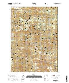
2020 Map of Johnson Saddle
USGS Topo · Published 2020About this map
The Malheur National Forest dominates this section of Grant County, where complex drainage networks carve through the high terrain. The land is defined by its water sources, including the reliable Bear Spring and the aptly named Tamarack Swamp in the southwest corner. Movement through this landscape is dictated by the topography around Johnson Saddle, a critical high-point passage between the watersheds of Fox Cr to the north and Beech Cr to the south. The abundance of named springs, such as Shreck Spring, Raddue Spring, and Cottonwood Spring, suggests the vital importance of water management in this forest environment. These features, combined with lookout points like Emergency Point, illustrate a landscape managed for conservation and fire monitoring, where the natural hydrology of streams like Little Bear Cr and Cottonwood Cr remains the primary architect of the geography.
Find a feature on this map
31 named features on this map. Tap any name to fly to it.
Don’t see what you’re looking for? This feature index may not catch every label — zoom into the map to look around manually.
Map Details
Editions of this 2020 Johnson Saddle Map
This is the sole edition of this map. No revisions or reprints were ever made.
Other maps of this area

1940 · Mount Vernon
USGS Topo · 1:62,500

1940 · John Day
USGS Topo · 1:62,500

1943 · John Day
USGS Topo · 1:62,500

1943 · Mount Vernon
USGS Topo · 1:62,500

1949 · Long Creek
USGS Topo · 1:62,500

1949 · Susanville
USGS Topo · 1:62,500

1951 · Susanville
USGS Topo · 1:62,500

1951 · Long Creek
USGS Topo · 1:62,500

1955 · Canyon City
USGS Topo · 1:250,000

1959 · Canyon City
USGS Topo · 1:250,000