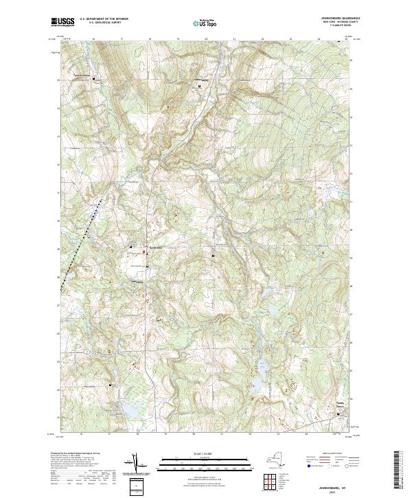
2023 Map of Johnsonburg
USGS Topo · Published 2023About this map
Tonawanda Creek and its various forks dictate the topography of this section of Wyoming County, where high ridges separate several prominent waterways. The landscape is defined by a series of long-established hamlets including Johnsonburg, North Java, and Southburg, each serving as a local hub for the surrounding agricultural lands. A remarkable density of burial grounds, such as the North Java Pioneer Cem and Humphrey Hollows Cem, suggests a long history of family settlement and continuity in the region. The map reveals how the modern road network, including Old Rte 98, still follows the contours of the land around natural features like Gallagher Swamp and the headwaters of Cayuga Creek. The southern portion of the sheet is marked by Faun Lake, while the eastern edge follows the course of East Koy Creek.
Find a feature on this map
61 named features on this map. Tap any name to fly to it.
Don’t see what you’re looking for? This feature index may not catch every label — zoom into the map to look around manually.
Map Details
Editions of this 2023 Johnsonburg Map
This is the sole edition of this map. No revisions or reprints were ever made.
Other maps of this area

1904 · Batavia
USGS Topo · 1:62,500

1905 · Attica
USGS Topo · 1:62,500

1905 · Portage
USGS Topo · 1:62,500

1923 · Arcade
USGS Topo · 1:62,500

1925 · Arcade
USGS Topo · 1:62,500

1943 · Warsaw
USGS Topo · 1:24,000

1943 · Pike
USGS Topo · 1:24,000

1944 · Pike
USGS Topo · 1:31,680

1944 · Warsaw
USGS Topo · 1:31,680

1949 · Attica
USGS Topo · 1:62,500