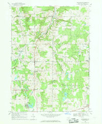
1966 Map of Johnsonburg
USGS Topo · Published 1968About this map
Johnsonburg sits at the northern end of this mid-1960s survey, where the Attica and Arcade Railroad follows the winding course of Tonawanda Creek. This rural section of Wyoming County is defined by its small crossroads settlements and a landscape of rolling hills and headwaters. The map records several historic cemeteries essential for genealogical research, including St Nicholas Cem and Silver Maple Cem near North Java, as well as Toziers Corners Cem further north.
Find a feature on this map
52 named features on this map. Tap any name to fly to it.
Don’t see what you’re looking for? This feature index may not catch every label — zoom into the map to look around manually.
Map Details
Editions of this 1966 Johnsonburg Map
This is the sole edition of this map. No revisions or reprints were ever made.
Other maps of this area

1904 · Batavia
USGS Topo · 1:62,500

1905 · Attica
USGS Topo · 1:62,500

1905 · Portage
USGS Topo · 1:62,500

1923 · Arcade
USGS Topo · 1:62,500

1925 · Arcade
USGS Topo · 1:62,500

1943 · Warsaw
USGS Topo · 1:24,000

1943 · Pike
USGS Topo · 1:24,000

1944 · Pike
USGS Topo · 1:31,680

1944 · Warsaw
USGS Topo · 1:31,680

1949 · Attica
USGS Topo · 1:62,500