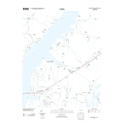
2013 Map of Johnsonville
USGS Topo · Published 2013About this map
Kentucky Lake dominates the western half of this landscape, its expansive waters meeting the meandering mouth of the Duck River at the southern edge. The area is defined by the transition from the river bottomlands of Flat Woods to the dissected hills of the eastern shore. The settlement of New Johnsonville stands as a focal point near the Hickman-Lockhart-Bridge, while older centers like Denver and Johnsonville sit further inland and along the shoreline.
Find a feature on this map
125 named features on this map. Tap any name to fly to it.
Don’t see what you’re looking for? This feature index may not catch every label — zoom into the map to look around manually.
Map Details
Editions of this 2013 Johnsonville Map
This is the sole edition of this map. No revisions or reprints were ever made.
Other maps of this area

1936 · Hurricane Mills
USGS Topo · 1:24,000

1936 · Camden
USGS Topo · 1:24,000

1936 · Big Sandy
USGS Topo · 1:24,000

1936 · Halls Creek
USGS Topo · 1:24,000

1936 · Johnsonville
USGS Topo · 1:24,000

1936 · Harmon Creek
USGS Topo · 1:24,000

1936 · Rockport
USGS Topo · 1:24,000

1936 · Waverly
USGS Topo · 1:24,000

1936 · Hustburg
USGS Topo · 1:24,000

1949 · Harmon Creek
USGS Topo · 1:24,000