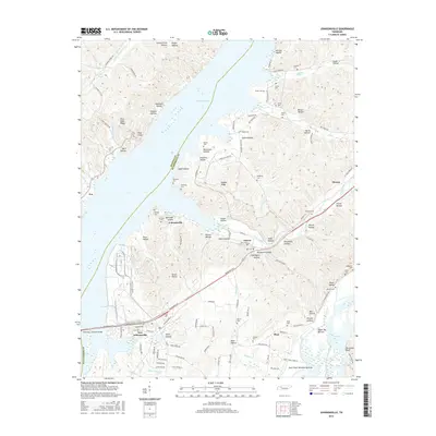
2016 Map of Johnsonville
USGS Topo · Published 2016About this map
Kentucky Lake dominates the central landscape of this Tennessee survey, serving as a geographical divide between Benton and Humphreys counties. The settlement patterns reflect the region's mid-century transformation, with the planned layout of New Johnsonville and the nearby Johnsonville situated along the eastern bank. The terrain is defined by a dense network of hollows and ridges, such as Nubbin Ridge and Pilot Knob, which funnel water into Harmon Cr and Trace Creek.
Find a feature on this map
128 named features on this map. Tap any name to fly to it.
Don’t see what you’re looking for? This feature index may not catch every label — zoom into the map to look around manually.
Map Details
Editions of this 2016 Johnsonville Map
This is the sole edition of this map. No revisions or reprints were ever made.
Other maps of this area

1936 · Hurricane Mills
USGS Topo · 1:24,000

1936 · Camden
USGS Topo · 1:24,000

1936 · Big Sandy
USGS Topo · 1:24,000

1936 · Halls Creek
USGS Topo · 1:24,000

1936 · Johnsonville
USGS Topo · 1:24,000

1936 · Harmon Creek
USGS Topo · 1:24,000

1936 · Rockport
USGS Topo · 1:24,000

1936 · Waverly
USGS Topo · 1:24,000

1936 · Hustburg
USGS Topo · 1:24,000

1949 · Harmon Creek
USGS Topo · 1:24,000