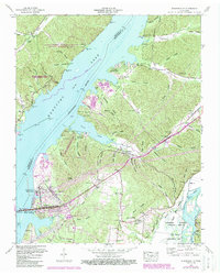
1950 Map of Johnsonville
USGS Topo · Published 1988About this map
Johnsonville (Abandoned) sits as a silent witness to the changing geography of the Tennessee River valley following the mid-century creation of Kentucky Lake. This landscape is defined by the tension between industrial progress and preservation, anchored by the massive Johnsonville Steam Plant and its associated ash disposal areas, juxtaposed against the vast Nathan Bedford Forrest State Park and the Tennessee Wildlife Refuge. The transition from the old riverfront life to modern infrastructure is evident in the relocation of the town center to New Johnsonville.
Find a feature on this map
92 named features on this map. Tap any name to fly to it.
Don’t see what you’re looking for? This feature index may not catch every label — zoom into the map to look around manually.
Map Details
Editions of this 1950 Johnsonville Map
4 editions found

Other maps of this area

1936 · Hurricane Mills
USGS Topo · 1:24,000

1936 · Camden
USGS Topo · 1:24,000

1936 · Big Sandy
USGS Topo · 1:24,000

1936 · Halls Creek
USGS Topo · 1:24,000

1936 · Johnsonville
USGS Topo · 1:24,000

1936 · Harmon Creek
USGS Topo · 1:24,000

1936 · Rockport
USGS Topo · 1:24,000

1936 · Waverly
USGS Topo · 1:24,000

1936 · Hustburg
USGS Topo · 1:24,000

1949 · Harmon Creek
USGS Topo · 1:24,000