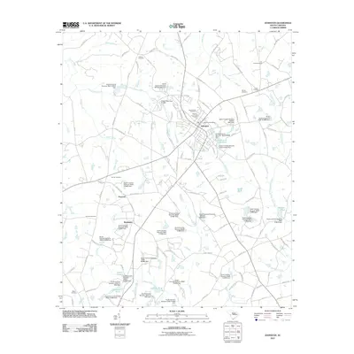
2011 Map of Johnston
USGS Topo · Published 2011About this map
Johnston serves as the central hub of this South Carolina landscape, surrounded by a network of smaller named settlements including Harmony and Bouknight. The terrain is defined by a complex drainage system feeding into the South Fork Edisto River, with numerous small water bodies such as Yance Pond, Salters Pond, and Holmes Pond punctuated by an extensive series of dams. These water features, many identified by South Carolina state dam numbers, illustrate the managed hydrology required for local agriculture and industry during this era.
Find a feature on this map
128 named features on this map. Tap any name to fly to it.
Don’t see what you’re looking for? This feature index may not catch every label — zoom into the map to look around manually.
Map Details
Editions of this 2011 Johnston Map
This is the sole edition of this map. No revisions or reprints were ever made.
Other maps of this area

1920 · Aiken
USGS Topo · 1:48,000

1921 · Aiken
USGS Topo · 1:62,500

1923 · Warrenville
USGS Topo · 1:48,000

1928 · Warrenville
USGS Topo · 1:62,500

1943 · Aiken
USGS Topo · 1:62,500

1943 · Warrenville
USGS Topo · 1:62,500

1954 · Augusta
USGS Topo · 1:250,000

1957 · Augusta
USGS Topo · 1:250,000

1958 · Augusta
USGS Topo · 1:250,000

1961 · Augusta
USGS Topo · 1:250,000