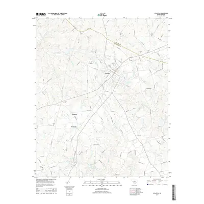
2017 Map of Johnston
USGS Topo · Published 2017About this map
Johnston serves as a central hub on this 2017 survey, situated along the Saluda Co Edgefield Co boundary. The landscape is characterized by a dense network of country roads and local water bodies, including Johnston Sc Reservoir and numerous small ponds like Reynolds Pond and Samuels Pond. To the south, the settlements of Harmony and Bouknight sit amidst a complex of creeks, most notably Shaw Cr and Tiger Cr. This area is a rich resource for genealogical research, documenting several family-named burial grounds such as Mount of Olives Cem, DeLoach Cem, and Bartley Cem. The hydrology is defined by the S Fork Edisto River, which drains the southeastern corner of the quadrangle, fed by tributaries like Hall Br and Flat Rock Br.
Find a feature on this map
117 named features on this map. Tap any name to fly to it.
Don’t see what you’re looking for? This feature index may not catch every label — zoom into the map to look around manually.
Map Details
Editions of this 2017 Johnston Map
This is the sole edition of this map. No revisions or reprints were ever made.
Other maps of this area

1920 · Aiken
USGS Topo · 1:48,000

1921 · Aiken
USGS Topo · 1:62,500

1923 · Warrenville
USGS Topo · 1:48,000

1928 · Warrenville
USGS Topo · 1:62,500

1943 · Aiken
USGS Topo · 1:62,500

1943 · Warrenville
USGS Topo · 1:62,500

1954 · Augusta
USGS Topo · 1:250,000

1957 · Augusta
USGS Topo · 1:250,000

1958 · Augusta
USGS Topo · 1:250,000

1961 · Augusta
USGS Topo · 1:250,000