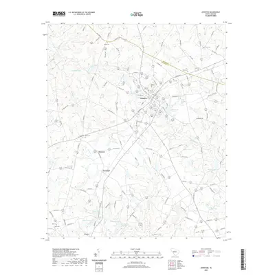
2020 Map of Johnston
USGS Topo · Published 2020About this map
Johnston serves as a central hub in this Upstate South Carolina landscape, positioned along the border where Saluda Co meets Edgefield Co. The town's layout reflects its development at a major road junction, surrounded by numerous family-named cemeteries and agricultural landmarks that document generations of local heritage. Notable burial sites including Mount of Olives Cem, Mount Nebo Cem, and Lott Cem are scattered throughout the quadrangle, serving as critical points for genealogical research.
Find a feature on this map
113 named features on this map. Tap any name to fly to it.
Don’t see what you’re looking for? This feature index may not catch every label — zoom into the map to look around manually.
Map Details
Editions of this 2020 Johnston Map
This is the sole edition of this map. No revisions or reprints were ever made.
Other maps of this area

1920 · Aiken
USGS Topo · 1:48,000

1921 · Aiken
USGS Topo · 1:62,500

1923 · Warrenville
USGS Topo · 1:48,000

1928 · Warrenville
USGS Topo · 1:62,500

1943 · Aiken
USGS Topo · 1:62,500

1943 · Warrenville
USGS Topo · 1:62,500

1954 · Augusta
USGS Topo · 1:250,000

1957 · Augusta
USGS Topo · 1:250,000

1958 · Augusta
USGS Topo · 1:250,000

1961 · Augusta
USGS Topo · 1:250,000