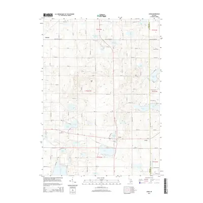
2014 Map of Jones
USGS Topo · Published 2014About this map
Jones serves as a central hub in this pocket of Michigan, situated at the junction of the Grand Trunk Western RR and several local thoroughfares like M-40. The landscape is heavily defined by its glacial hydrology, featuring a dense concentration of small water bodies such as Bair Lake, Corey Lake, and Lilly Lake. These lakes, alongside unique terrain features like Mt Misery and Bald Hill, suggest a region where seasonal recreation and agriculture coexist with the historical rail corridor.
Find a feature on this map
101 named features on this map. Tap any name to fly to it.
Don’t see what you’re looking for? This feature index may not catch every label — zoom into the map to look around manually.
Map Details
Editions of this 2014 Jones Map
This is the sole edition of this map. No revisions or reprints were ever made.
Other maps of this area

1914 · Three Rivers
USGS Topo · 1:62,500

1916 · Three Rivers
USGS Topo · 1:62,500

1922 · Schoolcraft
USGS Topo · 1:62,500

1943 · Three Rivers
USGS Topo · 1:62,500

1943 · Schoolcraft
USGS Topo · 1:62,500

1944 · Marcellus
USGS Topo · 1:62,500

1946 · Marcellus
USGS Topo · 1:62,500

1948 · Vandalia
USGS Topo · 1:62,500

1949 · Vandalia
USGS Topo · 1:62,500

1953 · Fort Wayne
USGS Topo · 1:250,000