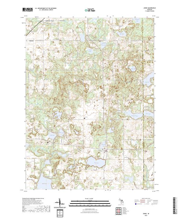
2023 Map of Jones
USGS Topo · Published 2023About this map
Glacial topography defines this corner of Cass County, where a dense concentration of kettle lakes and wetlands dictates the layout of local infrastructure. The settlement of Jones serves as a central hub, situated near Driskels Lake and Bair Lake, while the smaller hamlet of Wakelee sits to the northwest. Genealogists can identify several local burial grounds, including Poe Cem, Sand Hill Cem, and Lilly Lake Cem, which are scattered among the many water bodies. The landscape is punctuated by notable elevations such as Bald Hill and Mount Misery, providing a distinct contrast to the low-lying basins of Harwood Lake and Birch Lake. Evidence of early industry and transport is found in features like Streaters Mill Pond and the Keenum Airport, reflecting the evolution of this rural landscape from a mill-based economy to a modern residential and recreational area.
Find a feature on this map
68 named features on this map. Tap any name to fly to it.
Don’t see what you’re looking for? This feature index may not catch every label — zoom into the map to look around manually.
Map Details
Editions of this 2023 Jones Map
This is the sole edition of this map. No revisions or reprints were ever made.
Other maps of this area

1914 · Three Rivers
USGS Topo · 1:62,500

1916 · Three Rivers
USGS Topo · 1:62,500

1922 · Schoolcraft
USGS Topo · 1:62,500

1943 · Three Rivers
USGS Topo · 1:62,500

1943 · Schoolcraft
USGS Topo · 1:62,500

1944 · Marcellus
USGS Topo · 1:62,500

1946 · Marcellus
USGS Topo · 1:62,500

1948 · Vandalia
USGS Topo · 1:62,500

1949 · Vandalia
USGS Topo · 1:62,500

1953 · Fort Wayne
USGS Topo · 1:250,000
Featured Places
- Marcellus Township, MI
- Porter Township, MI
- Constantine Township, MI
- Flowerfield Township, MI
- Newberg Township, MI