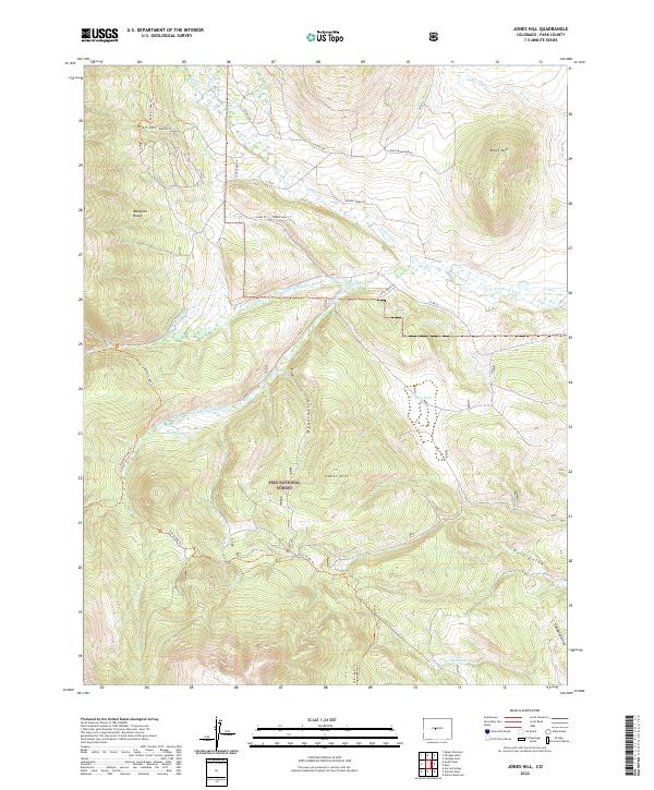
2022 Map of Jones Hill
USGS Topo · Published 2022About this map
The Pike National Forest dominates this landscape, where the high ridges of the Mosquito Range meet the vital waterways of Park County. The complex hydrography of the region is defined by the S Fork S Platte River and its numerous tributaries, including Twelvemile Cr and Rough and Tumbling Cr. Early agricultural and water management efforts are preserved through labels like Mikles Ditch and the Platte Station Ditch, which trace the movement of water across the varied terrain. Rising above the valleys are prominent landforms such as Jones Hill, Black Mountain, and the broad expanse of Long Park. The map also details numerous gulches like Watrous Gulch and Bear Gulch, alongside primitive routes such as the Sheep Creek Trl and Salt Creek Trl, which navigate the elevation changes of the eastern Rockies.
Find a feature on this map
38 named features on this map. Tap any name to fly to it.
Don’t see what you’re looking for? This feature index may not catch every label — zoom into the map to look around manually.
Map Details
Editions of this 2022 Jones Hill Map
This is the sole edition of this map. No revisions or reprints were ever made.
Other maps of this area

1889 · Leadville
USGS Topo · 1:125,000

1891 · Leadville
USGS Topo · 1:125,000

1942 · Leadville
USGS Topo · 1:125,000

1953 · Denver
USGS Topo · 1:250,000

1954 · Pueblo
USGS Topo · 1:250,000

1955 · Buena Vista
USGS Topo · 1:62,500

1956 · Garo
USGS Topo · 1:24,000

1956 · Antero Reservoir
USGS Topo · 1:24,000

1956 · Fairplay East
USGS Topo · 1:24,000

1956 · Montrose
USGS Topo · 1:250,000