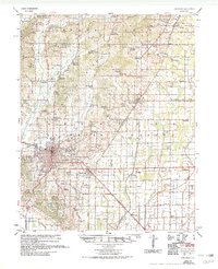
1958 Map of Jonesboro
USGS Topo · Published 1976About this map
Jonesboro serves as the focal point of this Mississippi River Commission survey, illustrating a mid-century Arkansas landscape defined by its agricultural drainage systems and educational expansion. The campus of Arkansas State College stands prominently at the city's northeast edge, while the surrounding countryside is partitioned by an extensive network of man-made waterways including Main Ditch, Big Ditch, and Moores Ditch. These engineering works, authorized under the Flood Control Act, transformed the lowlands between Big Creek and Lost Creek into productive acreage.
Find a feature on this map
196 named features on this map. Tap any name to fly to it.
Don’t see what you’re looking for? This feature index may not catch every label — zoom into the map to look around manually.
Map Details
Editions of this 1958 Jonesboro Map
2 editions found

Other maps of this area

1932 · Walnut Ridge
USGS Topo · 1:62,500

1935 · Sedgwick
USGS Topo · 1:62,500

1935 · Walnut Ridge
USGS Topo · 1:62,500

1939 · Weiner
USGS Topo · 1:62,500

1939 · Jonesboro
USGS Topo · 1:62,500

1940 · Dee
USGS Topo · 1:62,500

1940 · Gainesville
USGS Topo · 1:62,500

1940 · Marmaduke
USGS Topo · 1:62,500

1941 · Leachville
USGS Topo · 1:62,500

1941 · Marked Tree
USGS Topo · 1:62,500