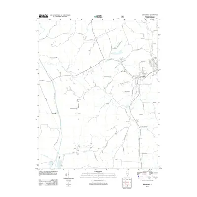
2012 Map of Jonesboro
USGS Topo · Published 2012About this map
Jonesboro serves as the focal point of this Union County survey, surrounded by a complex network of rural settlements and agricultural corridors. The landscape transitions from the protected timberlands of the Shawnee National Frst to the bottomlands along the Clear Creek Levee Rd. Distinctive local markers include the Atwood Lookout Tower atop Atwood Ridge and several family-named burial sites such as Kimmel Cem and Grieb Cem, which offer significant value for genealogical research in southern Illinois.
Find a feature on this map
76 named features on this map. Tap any name to fly to it.
Don’t see what you’re looking for? This feature index may not catch every label — zoom into the map to look around manually.
Map Details
Editions of this 2012 Jonesboro Map
This is the sole edition of this map. No revisions or reprints were ever made.
Other maps of this area

1920 · Jonesboro
USGS Topo · 1:62,500

1920 · Dongola
USGS Topo · 1:62,500

1922 · Carbondale
USGS Topo · 1:62,500

1923 · Dongola
USGS Topo · 1:62,500

1923 · Jonesboro
USGS Topo · 1:62,500

1924 · Alto Pass
USGS Topo · 1:62,500

1941 · Carbondale
USGS Topo · 1:62,500

1947 · Jonesboro
USGS Topo · 1:62,500

1947 · Alto Pass
USGS Topo · 1:62,500

1947 · Mc Clure
USGS Topo · 1:24,000