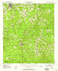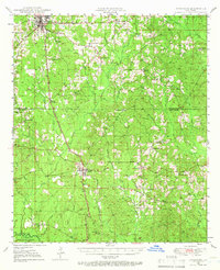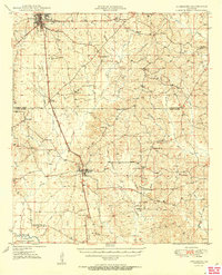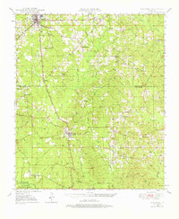
1949 Map of Jonesboro
USGS Topo · Published 1975About this map
Jonesboro serves as the focal point for this mid-century survey of North Central Louisiana, where the Chicago Rock Island and Pacific railroad bisects the landscape through Wyatt and Dodson. The terrain is defined by a dense network of timberlands and rural communities, punctuated by landmarks such as the Winona Lookout Tower and the southern reaches of the Kisatchie National Forest. The map documents a significant distribution of rural social centers, from the Gaars Mill School and Mt Hebron School to numerous country churches like Argola Church and Friendship Church. The drainage pattern is complex, dominated by the Dugdemona River and its many tributaries, including Cypress Creek, Flat Creek, and Hurricane Creek. An underground pipe line cutting across the northeastern quadrant indicates the region's developing energy infrastructure during the late 1940s.
Find a feature on this map
57 named features on this map. Tap any name to fly to it.
Don’t see what you’re looking for? This feature index may not catch every label — zoom into the map to look around manually.
Map Details
Editions of this 1949 Jonesboro Map
3 editions found