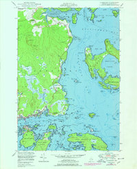
1948 Map of Jonesport
USGS Topo · Published 1978About this map
Jonesport and the island community of Beals anchor this coastal survey, where the seafaring life of Downeast Maine is etched into the landscape of coves and granite ledges. The maritime character of the region is evident in the U S Coast Guard Reservation at Little Pond Beach and the network of sheltered waterways like Moosabec Reach and Eastern Bay. Inland, the terrain is defined by numerous stretches of Heath, while small settlements like Monsapec and West Jonesport dot the rugged shoreline.
Find a feature on this map
96 named features on this map. Tap any name to fly to it.
Don’t see what you’re looking for? This feature index may not catch every label — zoom into the map to look around manually.
Map Details
Editions of this 1948 Jonesport Map
3 editions found
Other maps of this area

1918 · Machias
USGS Topo · 1:62,500

1921 · Great Wass Island
USGS Topo · 1:62,500

1921 · Columbia Falls
USGS Topo · 1:62,500

1921 · Columbia Falls
USGS Topo · 1:62,500

1941 · Columbia Falls
USGS Topo · 1:62,500

1941 · Machias
USGS Topo · 1:62,500

1942 · Columbia Falls
USGS Topo · 1:62,500

1948 · Jonesport
USGS Topo · 1:24,000
1948 · Columbia Falls
USGS Topo · 1:24,000

1948 · Roque Bluffs
USGS Topo · 1:24,000