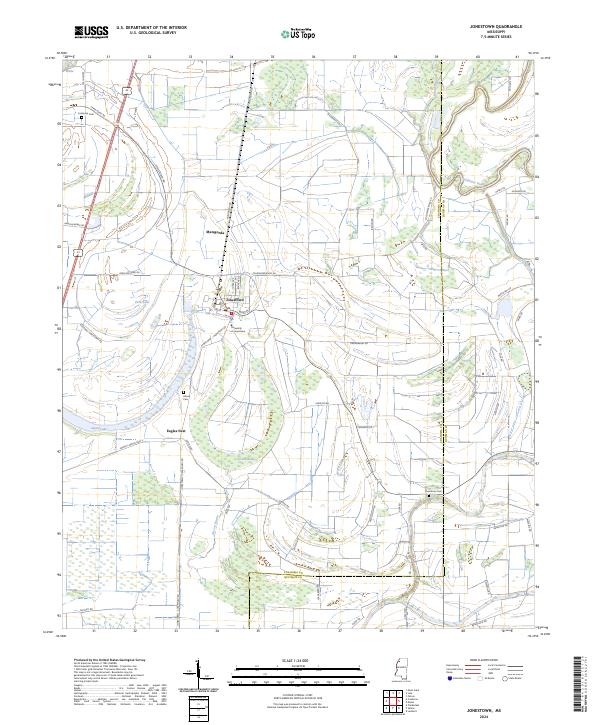
1969 Map of Jonestown
USGS Topo · Published 1971About this map
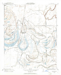
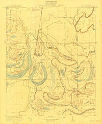
Jonestown sits as a central hub of this Mississippi Delta landscape, where the Illinois Central railroad cuts a straight north-south line through the alluvial plain. The area is defined by its complex hydrology, with the winding Coldwater River and a network of bayous and brakes that reflect the region's agricultural drainage patterns. Notable oxbow features like Swan Lake and Alcorn Lake dominate the terrain, surrounded by smaller named settlements such as Matagorda and Eagles Nest.
Find a feature on this map
34 named features on this map. Tap any name to fly to it.
Don’t see what you’re looking for? This feature index may not catch every label — zoom into the map to look around manually.
Map Details
Editions of this 1969 Jonestown Map
This is the sole edition of this map. No revisions or reprints were ever made.
Historical Maps of Jonestown Through Time
8 maps found