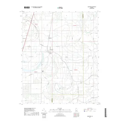
2018 Map of Jonestown
USGS Topo · Published 2018About this map
The town of Jonestown serves as the focal point of this Mississippi Delta landscape, situated along the winding course of the Coldwater River. This 2018 survey documents a region defined by its complex hydrography, including numerous swampy depressions and oxbow remnants such as Swan Lake, Tula Lake, and Hull Brake. The presence of the University of Jonestown and the neighboring settlement of Matagorda highlights the local community structure, while the rural surrounding area is dotted with family and community landmarks like the Alcorn Cem and Chrestman Cem. The map illustrates the transition from the Coahoma County interior toward the Quitman County line, showing a network of agricultural roads like Jonestown-Claremont Rd and Pear Orchard Rd that navigate the low-lying terrain. The interplay between the river and the brakes suggests a long history of managing the Delta's shifting waters for cultivation and settlement.
Find a feature on this map
54 named features on this map. Tap any name to fly to it.
Don’t see what you’re looking for? This feature index may not catch every label — zoom into the map to look around manually.
Map Details
Editions of this 2018 Jonestown Map
This is the sole edition of this map. No revisions or reprints were ever made.
Other maps of this area

1908 · Lula
USGS Topo · 1:24,000

1908 · Coahoma
USGS Topo · 1:24,000

1908 · Moon Lake
USGS Topo · 1:24,000

1908 · Jonestown
USGS Topo · 1:24,000

1910 · Coahoma
USGS Topo · 1:31,680

1910 · Jonestown
USGS Topo · 1:31,680

1912 · Moon Lake
USGS Topo · 1:31,680

1912 · Lula
USGS Topo · 1:31,680

1932 · Tutwiler
USGS Topo · 1:48,000

1932 · Marks
USGS Topo · 1:48,000