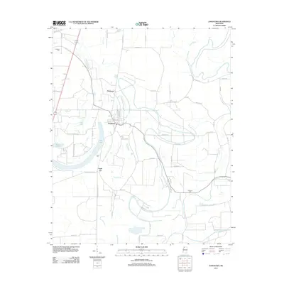
2012 Map of Jonestown
USGS Topo · Published 2012About this map
The Coldwater River snakes through the heart of this Coahoma County landscape, defining a terrain shaped by the slow movements of Delta water. The town of Jonestown serves as the central hub, with its street grid including Mosley St and S Church St clearly delineated. To the north, the small settlement of Matagorda sits near the riverbanks, while Eagles Nest is positioned further south. For those tracing family histories in the region, the map identifies three significant burial sites: Alcorn Cem near the river bend, Coahoma Cem to the northwest, and Chrestman Cem in the southeast. Large water bodies like Swan Lake and Tula Lake persist as prominent landmarks, while a complex network of roads such as Friars Point Hwy 61 and Co Hwy-143 connects these agricultural and riverfront communities.
Find a feature on this map
61 named features on this map. Tap any name to fly to it.
Don’t see what you’re looking for? This feature index may not catch every label — zoom into the map to look around manually.
Map Details
Editions of this 2012 Jonestown Map
This is the sole edition of this map. No revisions or reprints were ever made.
Other maps of this area

1908 · Lula
USGS Topo · 1:24,000

1908 · Coahoma
USGS Topo · 1:24,000

1908 · Moon Lake
USGS Topo · 1:24,000

1908 · Jonestown
USGS Topo · 1:24,000

1910 · Coahoma
USGS Topo · 1:31,680

1910 · Jonestown
USGS Topo · 1:31,680

1912 · Moon Lake
USGS Topo · 1:31,680

1912 · Lula
USGS Topo · 1:31,680

1932 · Tutwiler
USGS Topo · 1:48,000

1932 · Marks
USGS Topo · 1:48,000