
1958 Map of Jonesville
USGS Topo · Published 1963About this map
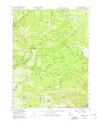
Jonesville and the high Sierra Nevada timberlands of the Lassen National Forest define this 1950s landscape, where three northern California counties converge. The terrain is a network of ridges and high-elevation meadows, including Humboldt Pk and Butt Mtn, which overlook the headwaters of Butte Creek and the Humbug River. Isolated outposts like the Butte Creek House and Ruffa Ranch indicate a landscape shaped by seasonal grazing and early mountain travel.
Find a feature on this map
107 named features on this map. Tap any name to fly to it.
Don’t see what you’re looking for? This feature index may not catch every label — zoom into the map to look around manually.
Map Details
Editions of this 1958 Jonesville Map
4 editions found

Other maps of this area

1886 · Lassen Peak
USGS Topo · 1:250,000

1888 · Bidwell Bar
USGS Topo · 1:125,000

1891 · Bidwell Bar
USGS Topo · 1:125,000

1891 · Chico
USGS Topo · 1:125,000

1892 · Lassen Peak
USGS Topo · 1:250,000

1893 · Chico
USGS Topo · 1:125,000

1893 · Bidwell Bar
USGS Topo · 1:125,000

1894 · Lassen Peak
USGS Topo · 1:250,000

1895 · Bidwell Bar
USGS Topo · 1:125,000

1895 · Chico
USGS Topo · 1:125,000