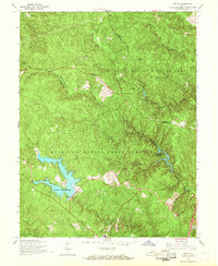
1966 Map of Joplin
USGS Topo · Published 1968About this map
The Quantico Marine Corps Schools dominate the southern portion of this mid-1960s survey, marking a period of significant military infrastructure in Northern Virginia. The landscape is defined by the complex hydrology of Quantico Creek and its many branches, notably where the Lunga Reservoir and Breckenridge Reservoir have been established. These water bodies contrast with the heavily wooded elevations of Prince William Forest Park to the north, which includes recreational areas like the Oak Ridge Campground and elevated landmarks such as Hickory Ridge.
Find a feature on this map
24 named features on this map. Tap any name to fly to it.
Don’t see what you’re looking for? This feature index may not catch every label — zoom into the map to look around manually.
Map Details
Editions of this 1966 Joplin Map
4 editions found
Other maps of this area

1887 · Spottsylvania
USGS Topo · 1:125,000

1889 · Fredericksburg
USGS Topo · 1:125,000

1890 · Mt. Vernon
USGS Topo · 1:125,000

1891 · Mt. Vernon
USGS Topo · 1:125,000

1892 · Fredericksburg
USGS Topo · 1:125,000

1892 · Spottsylvania
USGS Topo · 1:125,000

1894 · Warrenton
USGS Topo · 1:125,000

1894 · Fredericksburg
USGS Topo · 1:125,000

1894 · Mt. Vernon
USGS Topo · 1:125,000

1897 · Mt. Vernon
USGS Topo · 1:125,000