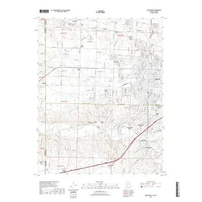
2017 Map of Joplin West
USGS Topo · Published 2017About this map
The western suburbs of Joplin and the Kansas Missouri state line define this 2017 landscape, where the urban grid of the city meets a series of deeply carved hollows and drainage basins. The northern portion of the map is dominated by names reflecting a transition from mining era history to modern residential development, including Chitwood, Leadville Hollow, and Lone Elm. These hollows, along with Opossum Hollow and Chitwood Hollow, feed into Turkey Creek, illustrating the complex topography that once supported regional lead and zinc production.
Find a feature on this map
172 named features on this map. Tap any name to fly to it.
Don’t see what you’re looking for? This feature index may not catch every label — zoom into the map to look around manually.
Map Details
Editions of this 2017 Joplin West Map
This is the sole edition of this map. No revisions or reprints were ever made.
Other maps of this area

1886 · Joplin
USGS Topo · 1:125,000

1886 · Carthage
USGS Topo · 1:125,000

1894 · Joplin
USGS Topo · 1:125,000

1894 · Carthage
USGS Topo · 1:125,000

1907 · Wyandotte
USGS Topo · 1:125,000

1909 · Wyandotte
USGS Topo · 1:125,000

1916 · Neosho
USGS Topo · 1:62,500

1947 · Joplin
USGS Topo · 1:250,000

1949 · Joplin
USGS Topo · 1:250,000

1949 · Racine
USGS Topo · 1:24,000