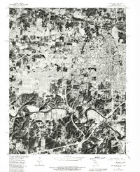
1980 Map of Joplin West
USGS Topo · Published 1982About this map
Joplin dominates the eastern half of this orthophotoquad, showing the dense grid and urban development of the city as it appeared in the early 1980s. The landscape transitions quickly from the urban core to the more dispersed settlements of Central City, Belle Center, and Belleville to the north and west. This unique photographic perspective, derived from 1980 aerial imagery, provides a literal view of the land use patterns along the Missouri-Kansas border, including the industrial and residential corridors connecting Joplin to Galena.
Find a feature on this map
12 named features on this map. Tap any name to fly to it.
Don’t see what you’re looking for? This feature index may not catch every label — zoom into the map to look around manually.
Map Details
Editions of this 1980 Joplin West Map
This is the sole edition of this map. No revisions or reprints were ever made.
Other maps of this area

1886 · Joplin
USGS Topo · 1:125,000

1886 · Carthage
USGS Topo · 1:125,000

1894 · Joplin
USGS Topo · 1:125,000

1894 · Carthage
USGS Topo · 1:125,000

1907 · Wyandotte
USGS Topo · 1:125,000

1909 · Wyandotte
USGS Topo · 1:125,000

1916 · Neosho
USGS Topo · 1:62,500

1947 · Joplin
USGS Topo · 1:250,000

1949 · Joplin
USGS Topo · 1:250,000

1949 · Racine
USGS Topo · 1:24,000