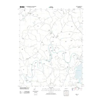
2010 Map of Joppa
USGS Topo · Published 2010About this map
Cherokee Lake dominates the southeastern corner of this map, its waters held by the Cherokee Dam on the Holston River. This landscape is defined by the winding river and its many geographical features, including Horse Shoe Bend and Mule Shoe Bend, alongside several named shoals and islands like Smoky Island and Julian Nance Island. The area reflects a deep-rooted local history with numerous family-named cemeteries such as Joppa Cemetery, Stalsworth Cemetery, and Nance Cemetery. The presence of the Buffalo Springs State Hatchery and Mill Spring Mill indicates the historical importance of the local waterways for both industry and natural resource management. Transportation routes like Old Stage Coach Rd and the crossing at John K Shields Bridge link the various knolls and ridges, such as Poor Valley Knobs and Indian Ridge, which shape the local terrain.
Find a feature on this map
139 named features on this map. Tap any name to fly to it.
Don’t see what you’re looking for? This feature index may not catch every label — zoom into the map to look around manually.
Map Details
Editions of this 2010 Joppa Map
This is the sole edition of this map. No revisions or reprints were ever made.
Other maps of this area

1883 · Morristown
USGS Topo · 1:125,000

1893 · Morristown
USGS Topo · 1:125,000

1895 · Morristown
USGS Topo · 1:125,000

1897 · Maynardville
USGS Topo · 1:125,000

1900 · Maynardville
USGS Topo · 1:125,000

1935 · Luttrell
USGS Topo · 1:24,000

1935 · Mascot
USGS Topo · 1:24,000

1935 · Tate Springs
USGS Topo · 1:48,000

1935 · Straw Plains
USGS Topo · 1:48,000

1935 · Joppa
USGS Topo · 1:24,000