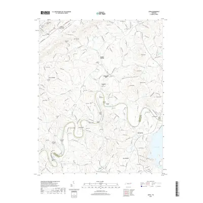
2019 Map of Joppa
USGS Topo · Published 2019About this map
Massengill Mill and its associated Massengill Cem stand as significant landmarks along the winding course of the Holston River, illustrating the historic grain and timber processing centers of this river-oriented economy. The landscape is defined by the tight bends and islands of the river, including Horse Shoe Bend, Gilmore Island, and Julian Nance Island, which historically dictated settlement patterns and transport routes. Numerous family and community burial grounds, such as the Jim Walker Cem, Stalsworth Cem, and Pleasant View Cemetery, are scattered among the ridges of the Richland Knobs and Indian Ridge. The map shows the area as it transitioned toward modern utility with the Cherokee Lake reservoir and the Landing at River's Edge Airport, while still retaining the traditional footprints of crossroads like Buffalo Springs, Tampico, and New Corinth.
Find a feature on this map
185 named features on this map. Tap any name to fly to it.
Don’t see what you’re looking for? This feature index may not catch every label — zoom into the map to look around manually.
Map Details
Editions of this 2019 Joppa Map
This is the sole edition of this map. No revisions or reprints were ever made.
Other maps of this area

1883 · Morristown
USGS Topo · 1:125,000

1893 · Morristown
USGS Topo · 1:125,000

1895 · Morristown
USGS Topo · 1:125,000

1897 · Maynardville
USGS Topo · 1:125,000

1900 · Maynardville
USGS Topo · 1:125,000

1935 · Luttrell
USGS Topo · 1:24,000

1935 · Mascot
USGS Topo · 1:24,000

1935 · Tate Springs
USGS Topo · 1:48,000

1935 · Straw Plains
USGS Topo · 1:48,000

1935 · Joppa
USGS Topo · 1:24,000