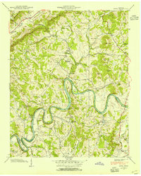
1938 Map of Joppa
USGS Topo · Published 1954About this map
Holston River carves a deep, serpentine path through this 1938 landscape, defining the boundary between Grainger and Jefferson counties. The terrain is marked by the steep ridges of Poor Valley Knobs and the broader expanse of Poor Valley, where rural life is anchored by family-run landmarks like Miller Store, Roach Store, and Hammer Store. The presence of CCC Camp No 8 and the Buffalo Springs Fish and Game Preserve points to early 20th-century conservation efforts and labor programs in the region. Genealogists can find significant local markers such as Haworth Cem near the river bends and Indian Ridge Sch. The map also reveals the geological character of the area through features like Indian Cave and the Little Jump Rapids, showing a landscape where small-scale milling at Massengill Mill and Pecks Mill relied on the abundant local springs and creeks.
Find a feature on this map
54 named features on this map. Tap any name to fly to it.
Don’t see what you’re looking for? This feature index may not catch every label — zoom into the map to look around manually.
Map Details
Editions of this 1938 Joppa Map
This is the sole edition of this map. No revisions or reprints were ever made.
Other maps of this area

1883 · Morristown
USGS Topo · 1:125,000

1893 · Morristown
USGS Topo · 1:125,000

1895 · Morristown
USGS Topo · 1:125,000

1897 · Maynardville
USGS Topo · 1:125,000

1900 · Maynardville
USGS Topo · 1:125,000

1935 · Luttrell
USGS Topo · 1:24,000

1935 · Mascot
USGS Topo · 1:24,000

1935 · Tate Springs
USGS Topo · 1:48,000

1935 · Straw Plains
USGS Topo · 1:48,000

1935 · Joppa
USGS Topo · 1:24,000