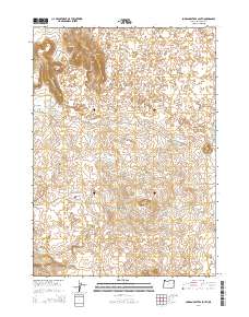
2014 Map of Jordan Craters South
USGS Topo · Published 2014About this map
Jordan Craters dominates this high-desert landscape in southeastern Oregon, revealing a terrain defined by volcanic activity and sparse water management. The geomorphology is punctuated by prominent rises such as Clarks Butte, Biscuit Butte, and Lava Butte, which break the horizontal expanse of the Malheur County plateau. These volcanic features are surrounded by a series of small, vital water catchments, including Lava Reservoir and Saddle Butte Reservoir 2, indicating the historical importance of water storage in this arid environment. The presence of Crater Lake nestled among the peaks highlights the specific geological formations of the volcanic field. Access is maintained through limited transit corridors like Biscuit Butte Rd and Dry Lake Reservoir Rd, which connect these remote topographical landmarks and reservoirs across the township boundaries.
Find a feature on this map
18 named features on this map. Tap any name to fly to it.
Don’t see what you’re looking for? This feature index may not catch every label — zoom into the map to look around manually.
Map Details
Editions of this 2014 Jordan Craters South Map
This is the sole edition of this map. No revisions or reprints were ever made.
Other maps of this area

1955 · Jordan Valley
USGS Topo · 1:250,000

1955 · Boise
USGS Topo · 1:250,000

1957 · Jordan Valley
USGS Topo · 1:250,000

1958 · Boise
USGS Topo · 1:250,000

1958 · Jordan Valley
USGS Topo · 1:250,000

1962 · Boise
USGS Topo · 1:250,000

1969 · Jordan Craters South
USGS Topo · 1:24,000

1969 · Mc Cain Creek
USGS Topo · 1:24,000

1969 · Jordan Craters North
USGS Topo · 1:24,000

1969 · Cow Lakes
USGS Topo · 1:24,000