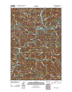
2011 Map of Jordan Creek
USGS Topo · Published 2011About this map
Lees Camp stands as a notable point along the Wilson River in this coastal mountain landscape of northwest Oregon. The river system dominates the hydrology, fed by a complex network of tributaries including Lehman Creek, Cedar Creek, and Ryan Creek, which features the Ryan Creek Reservoir. The terrain is defined by prominent high points and ridges such as Kings Mountain, Diamond Hill, and Ax Ridge, which historically dictated the paths of logging roads and early transit routes. Evidence of water management and local industry is visible through sites like Archer Pond and the numerous small creeks like Ben Smith Creek and Phipps Creek that carve through the steep timberlands. A series of primary access roads, including Jordan Creek Rd and Jones Creek Rd, follow the natural contours of the ridges, connecting the small settlement of Jordan Creek to the broader regional forest network.
Find a feature on this map
55 named features on this map. Tap any name to fly to it.
Don’t see what you’re looking for? This feature index may not catch every label — zoom into the map to look around manually.
Map Details
Editions of this 2011 Jordan Creek Map
This is the sole edition of this map. No revisions or reprints were ever made.
Other maps of this area

1937 · Enright
USGS Topo · 1:62,500

1941 · Timber
USGS Topo · 1:62,500

1941 · Enright
USGS Topo · 1:62,500

1942 · Ginger Peak
USGS Topo · 1:62,500

1942 · Fairdale
USGS Topo · 1:62,500

1948 · Vancouver
USGS Topo · 1:250,000

1950 · Vancouver
USGS Topo · 1:250,000

1950 · Vancouver
USGS Topo · 1:250,000

1955 · Blaine
USGS Topo · 1:62,500

1955 · Timber
USGS Topo · 1:62,500