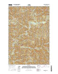
2017 Map of Jordan Creek
USGS Topo · Published 2017About this map
Jordan Creek and the Wilson River define this corner of the Northern Oregon Coast Range as it appeared in the late 2010s. The landscape is dominated by a complex network of ridgelines and watercourses, with high points such as Kings Mtn and Diamond Hill overlooking a deeply incised drainage system. The drainage pattern is exceptionally dense, featuring numerous named creeks like Lester Cr, Runyon Cr, and Stanley Cr, as well as the significant North Fork Wilson River.
Find a feature on this map
56 named features on this map. Tap any name to fly to it.
Don’t see what you’re looking for? This feature index may not catch every label — zoom into the map to look around manually.
Map Details
Editions of this 2017 Jordan Creek Map
This is the sole edition of this map. No revisions or reprints were ever made.
Other maps of this area

1937 · Enright
USGS Topo · 1:62,500

1941 · Timber
USGS Topo · 1:62,500

1941 · Enright
USGS Topo · 1:62,500

1942 · Ginger Peak
USGS Topo · 1:62,500

1942 · Fairdale
USGS Topo · 1:62,500

1948 · Vancouver
USGS Topo · 1:250,000

1950 · Vancouver
USGS Topo · 1:250,000

1950 · Vancouver
USGS Topo · 1:250,000

1955 · Blaine
USGS Topo · 1:62,500

1955 · Timber
USGS Topo · 1:62,500