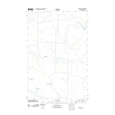
2011 Map of Jordan NW
USGS Topo · Published 2011About this map
Garfield County ranching lands north of Jordan are defined by a network of seasonal watercourses and earthen dams in this 2011 survey. Named features such as Stinebaugh Number 1 Dam and B Murion Number 5 Dam reflect a landscape engineered to manage the intermittent flows of Bear Creek and Frazier Creek. These water management features are critical to the agricultural operations in this part of Montana, where the terrain is traversed by remote thoroughfares like Hell Creek Rd and Stinebaugh Rd. The presence of numerous numbered dams, including Stinebaugh Number 2 Dam and Murion B Number 4 Dam, illustrates the specific land ownership and resource development patterns of the area. This topographic record documents a vast, sparsely populated region where White Horse Creek and Vail Creek provide the primary drainage through the rolling breaks and plains.
Find a feature on this map
12 named features on this map. Tap any name to fly to it.
Don’t see what you’re looking for? This feature index may not catch every label — zoom into the map to look around manually.
Map Details
Editions of this 2011 Jordan NW Map
This is the sole edition of this map. No revisions or reprints were ever made.
Other maps of this area

1954 · Jordan
USGS Topo · 1:250,000

1956 · Jordan
USGS Topo · 1:250,000

1958 · Jordan
USGS Topo · 1:250,000

1958 · Maloney Hill
USGS Topo · 1:62,500

1964 · Jordan
USGS Topo · 1:250,000

1964 · Jordan SE
USGS Topo · 1:24,000

1964 · Jordan NE
USGS Topo · 1:24,000

1964 · Jordan NW
USGS Topo · 1:24,000

1964 · Jordan
USGS Topo · 1:24,000

1971 · Trumbo Ranch
USGS Topo · 1:24,000