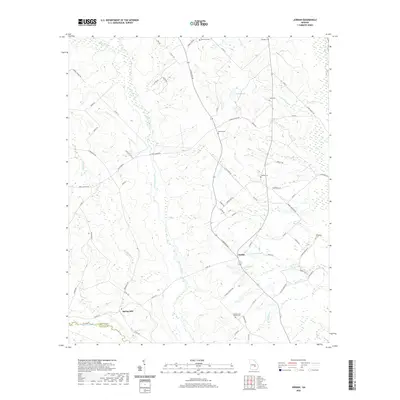
2020 Map of Jordan
USGS Topo · Published 2020About this map
Jordan and Spring Hill serve as the primary focal points of this Wheeler County landscape, which is defined by the winding course of Alligator Creek and the Little Ocmulgee River. The map reveals a rural community where family and community heritage is preserved through numerous burial sites, including the Browning Cem, Starlight Cem, and the uniquely named Spencer and Baker Cem. These locations, along with Livingston Cem, provide essential data for genealogists tracing South Georgia ancestry. The terrain is marked by a network of local roads such as S State Rte 126 and Cotton Rd, connecting isolated farmsteads to water sources like Smith Pond and Stewart Pond. The southern boundary follows the natural divide of the river where Wheeler Co meets Telfair Co, illustrating how the waterway has historically shaped regional administrative lines.
Find a feature on this map
72 named features on this map. Tap any name to fly to it.
Don’t see what you’re looking for? This feature index may not catch every label — zoom into the map to look around manually.
Map Details
Editions of this 2020 Jordan Map
This is the sole edition of this map. No revisions or reprints were ever made.
Other maps of this area

1953 · Waycross
USGS Topo · 1:250,000

1957 · Macon
USGS Topo · 1:250,000

1958 · Macon
USGS Topo · 1:250,000

1958 · Waycross
USGS Topo · 1:250,000

1964 · Macon
USGS Topo · 1:250,000

1970 · Scotland
USGS Topo · 1:24,000

1970 · Glenwood
USGS Topo · 1:24,000

1970 · Alamo
USGS Topo · 1:24,000

1970 · Mount Vernon
USGS Topo · 1:24,000

1970 · Uvalda
USGS Topo · 1:24,000