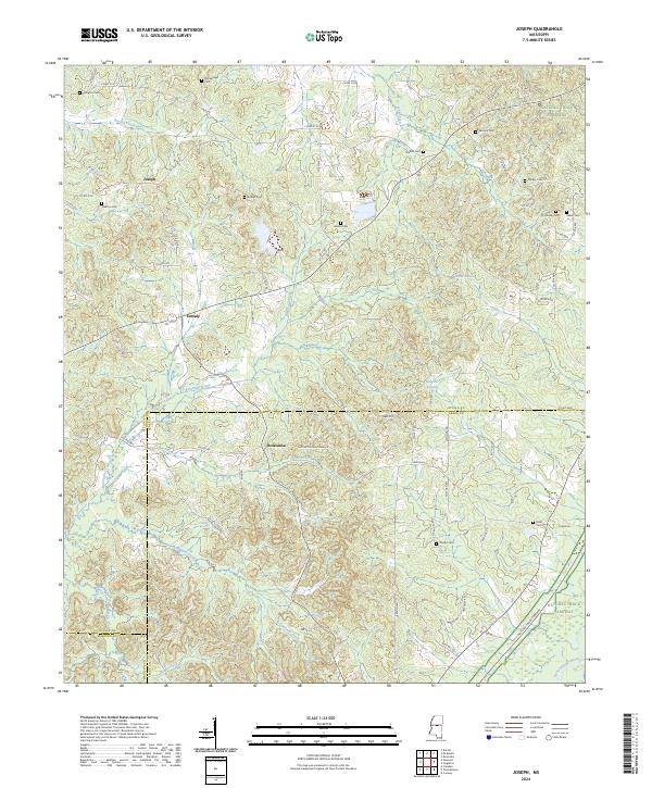
2024 Map of Joseph
USGS Topo · Published 2024About this map
Bolatusha and the rural crossings of Zemuly and Joseph define this landscape where the boundaries of Attala, Leake, and Madison counties converge. The terrain is defined by a dense network of waterways including Fisher Creek, Long Creek, and Bolatusha Creek, which drain toward the Yockanookany River in the southeast. This 2024 map documents the preservation of the Natchez Trace Parkway as it cuts diagonally through the eastern sections, maintaining its historical corridor through the wooded hills.
Find a feature on this map
75 named features on this map. Tap any name to fly to it.
Don’t see what you’re looking for? This feature index may not catch every label — zoom into the map to look around manually.
Map Details
Editions of this 2024 Joseph Map
This is the sole edition of this map. No revisions or reprints were ever made.
Other maps of this area

1953 · Meridian
USGS Topo · 1:250,000

1953 · West Point
USGS Topo · 1:250,000

1957 · Meridian
USGS Topo · 1:250,000

1958 · West Point
USGS Topo · 1:250,000

1962 · Thomastown
USGS Topo · 1:62,500

1963 · West Point
USGS Topo · 1:250,000

1964 · Camden
USGS Topo · 1:24,000

1964 · Newport
USGS Topo · 1:24,000
1964 · Durant
USGS Topo · 1:24,000

1964 · Kosciusko
USGS Topo · 1:24,000