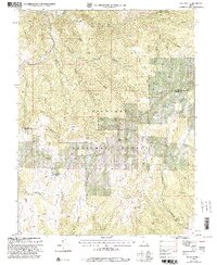
2001 Map of Joseph Peak
USGS Topo · Published 2003About this map
Fishlake National Forest encompasses the high mountain ridges and deep drainages along the border of Millard and Sevier Counties. High points such as Joseph Peak and Lion Peak dominate the skyline, while the landscape below is defined by complex canyon systems like Kanosh Canyon and Sam Stowe Canyon. The distribution of water is critical in this high-altitude environment, evidenced by named sources such as Big Spring, Pond Spring, and Cottonwood Spring.
Find a feature on this map
52 named features on this map. Tap any name to fly to it.
Don’t see what you’re looking for? This feature index may not catch every label — zoom into the map to look around manually.
Map Details
Editions of this 2001 Joseph Peak Map
This is the sole edition of this map. No revisions or reprints were ever made.
Other maps of this area

1885 · Beaver
USGS Topo · 1:250,000

1932 · Sevier
USGS Topo · 1:62,500

1935 · Sevier
USGS Topo · 1:62,500

1940 · Monroe
USGS Topo · 1:62,500

1944 · Monroe
USGS Topo · 1:62,500

1953 · Richfield
USGS Topo · 1:250,000

1958 · Richfield
USGS Topo · 1:250,000

1961 · Richfield
USGS Topo · 1:62,500

1962 · Fillmore
USGS Topo · 1:62,500
1980 · Antelope Range
USGS Topo · 1:24,000