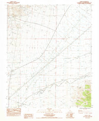
1983 Map of Joshua
USGS Topo · Published 1983About this map
Mining operations and arid drainage patterns characterize this 1980s landscape at the intersection of the Ivanpah Mountains and New York Mountains. Gold and silver seekers can trace the legacy of industrial extraction through the noted Morning Star Mine, Kewanee Mine, and Allured Mine, which are situated along the northern slopes. The area is dominated by the broad expanse of the Ivanpah Valley, where a complex network of Wash and Sand Washes indicates the seasonal movement of water through the desert floor. Infrastructure of the era is represented by a corridor of Steel Tower Power Lines and a system of Levee structures designed for water management. A rare reliable water source, Sacaton Spring, is tucked away in the southern mountainous terrain, providing a critical landmark for researchers of the local desert environment.
Find a feature on this map
16 named features on this map. Tap any name to fly to it.
Don’t see what you’re looking for? This feature index may not catch every label — zoom into the map to look around manually.
Map Details
Editions of this 1983 Joshua Map
2 editions found
Other maps of this area

1910 · Ivanpah
USGS Topo · 1:250,000

1912 · Ivanpah
USGS Topo · 1:250,000

1942 · Ivanpah
USGS Topo · 1:250,000

1947 · Kingman
USGS Topo · 1:250,000

1948 · Kingman
USGS Topo · 1:250,000

1954 · Kingman
USGS Topo · 1:250,000

1955 · Kingman
USGS Topo · 1:250,000

1955 · Mescal Range
USGS Topo · 1:62,500

1955 · Mid Hills
USGS Topo · 1:62,500

1955 · Kelso
USGS Topo · 1:62,500