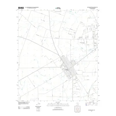
2013 Map of Jourdanton
USGS Topo · Published 2013About this map
Jourdanton serves as the focal point of this south Texas landscape, where a dense grid of residential streets and local thoroughfares transitions into a territory of ranch lands and drainage basins. The area is defined by the winding course of the Atascosa River to the northeast and the multiple forks of Goose Cr and Salt Br that cut across the western prairies. Local aviation is well-represented by both the Pleasanton Municipal Airport and the private Maurice Dauwe Farm Airport, reflecting the region's reliance on air transport for agricultural and municipal connectivity.
Find a feature on this map
107 named features on this map. Tap any name to fly to it.
Don’t see what you’re looking for? This feature index may not catch every label — zoom into the map to look around manually.
Map Details
Editions of this 2013 Jourdanton Map
This is the sole edition of this map. No revisions or reprints were ever made.
Other maps of this area

1953 · Crystal City
USGS Topo · 1:250,000

1954 · San Antonio
USGS Topo · 1:250,000

1955 · Crystal City
USGS Topo · 1:250,000

1956 · Pleasanton
USGS Topo · 1:62,500

1956 · Jourdanton
USGS Topo · 1:62,500

1957 · San Antonio
USGS Topo · 1:250,000

1961 · Crystal City
USGS Topo · 1:250,000

1964 · Leming
USGS Topo · 1:24,000

1968 · Crystal City
USGS Topo · 1:250,000
1968 · Jourdanton
USGS Topo · 1:24,000